Canada Maps Home > Canada Map Collection > Firth River Map - IMW
International Map of The World: Firth River: IMW-nr7_9
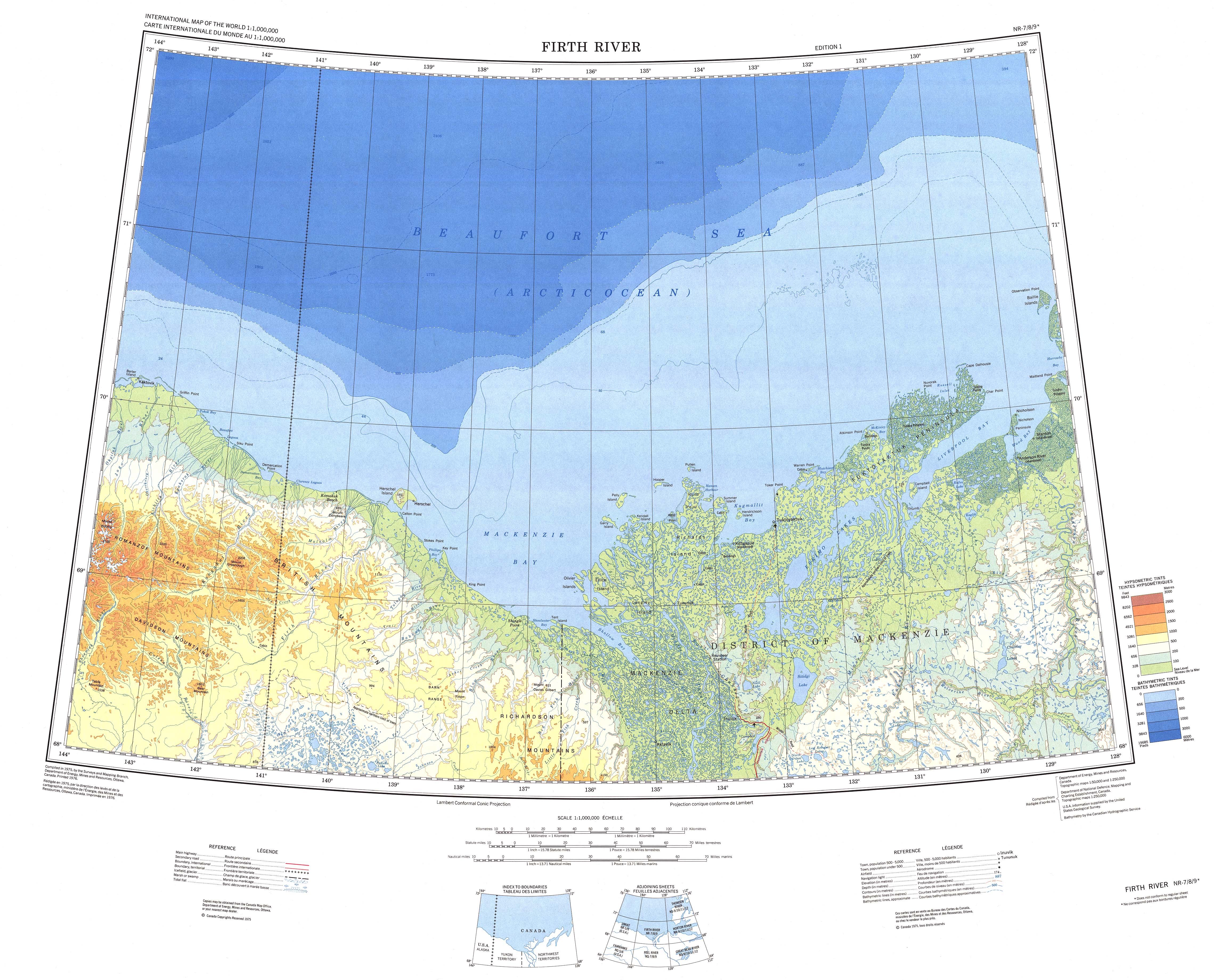
Above, you can see a plain sketch laying out the geography of this environs with a plain array of features.
You have permission to use this map and use it in your work. Citing this page is our request.
On the assumption you are hoping for support obtaining a map, a different kind of map, or are hoping for a first-class tailor-made production, I suggest you contact us.
Acquire good tailor-made maps from us. Cuztomized maps by YellowMaps embrace a large collection of features, for instance: thoroughfares, scale bar, UTM coordinates, campsites, conservation areas, sea features, hamlets, or rivers, etc. Map types run from economic geography to locator, navigation to general reference, county level to planning regions.
First-Class maps are clear, all-inclusive, and not unclear. Detail-Oriented map design by YellowMaps.
To acquire printed maps or charts, such as recreation atlases, state maps, or hiking maps, simply marvel at the cartographic delights in our online map shop It has tens of thousands maps.
A lot of our maps get printed on-demand. They are always available.
Back to Canada map collection