Canada Maps Home > Canada Map Collection > Rowley River Map - IMW
International Map of The World: Rowley River: IMW-nr17_20
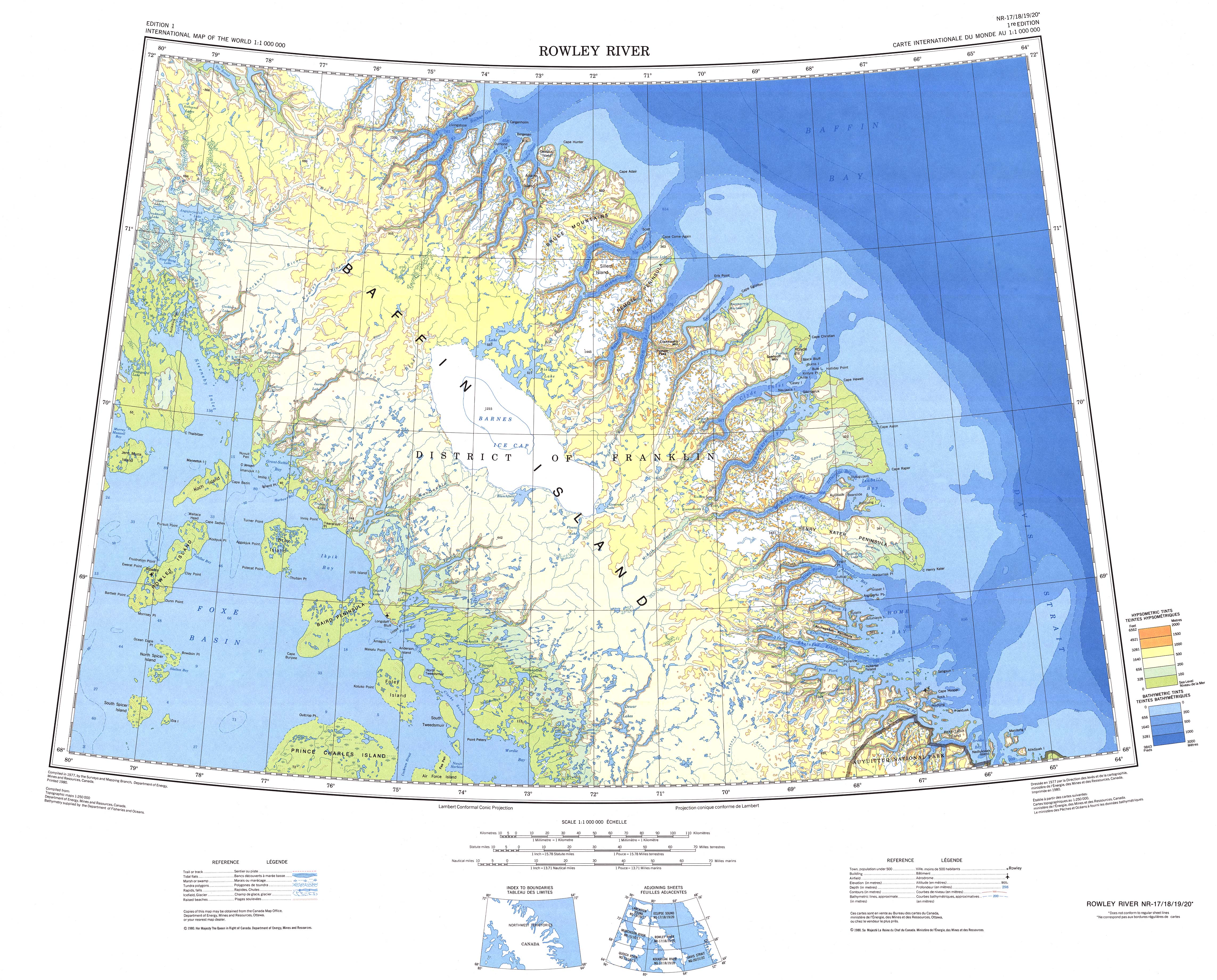
Above is a classic graphic that lays out the geography of this area of interest with a simple collection of map elements.
You have permission to download this file and work with it in your projects. Giving credit to this webpage is very much appreciated.
In the event you desire aid acquiring a map, a distinct kind of map, or desire a high quality custom-built preparation, do not hesitate to get in touch with us.
Order superior tailor-made maps from us. A custom map made by us have a refreshing selection of map components, e.g.: roads, scale bar, UTM coordinates, air navigation features, indian reserves, springs, hydraulic construction, or rivers, etc. Types of maps reach from street to navigational, folded to rolled, electoral district to school districts.
High Quality maps are specific, clear-cut, and not deceptive. First-Rate map design by YellowMaps.
To purchase printed maps or charts, e.g. road atlases, maps for kids, or hiking maps, do not hesitate to visit our map shop We carry tens of thousands map items.
Maps are beautiful.
Back to Canada map collection