Canada Maps Home > Canada Map Collection > Lockhart River Map - IMW
International Map of The World: Lockhart River: IMW-np12_13
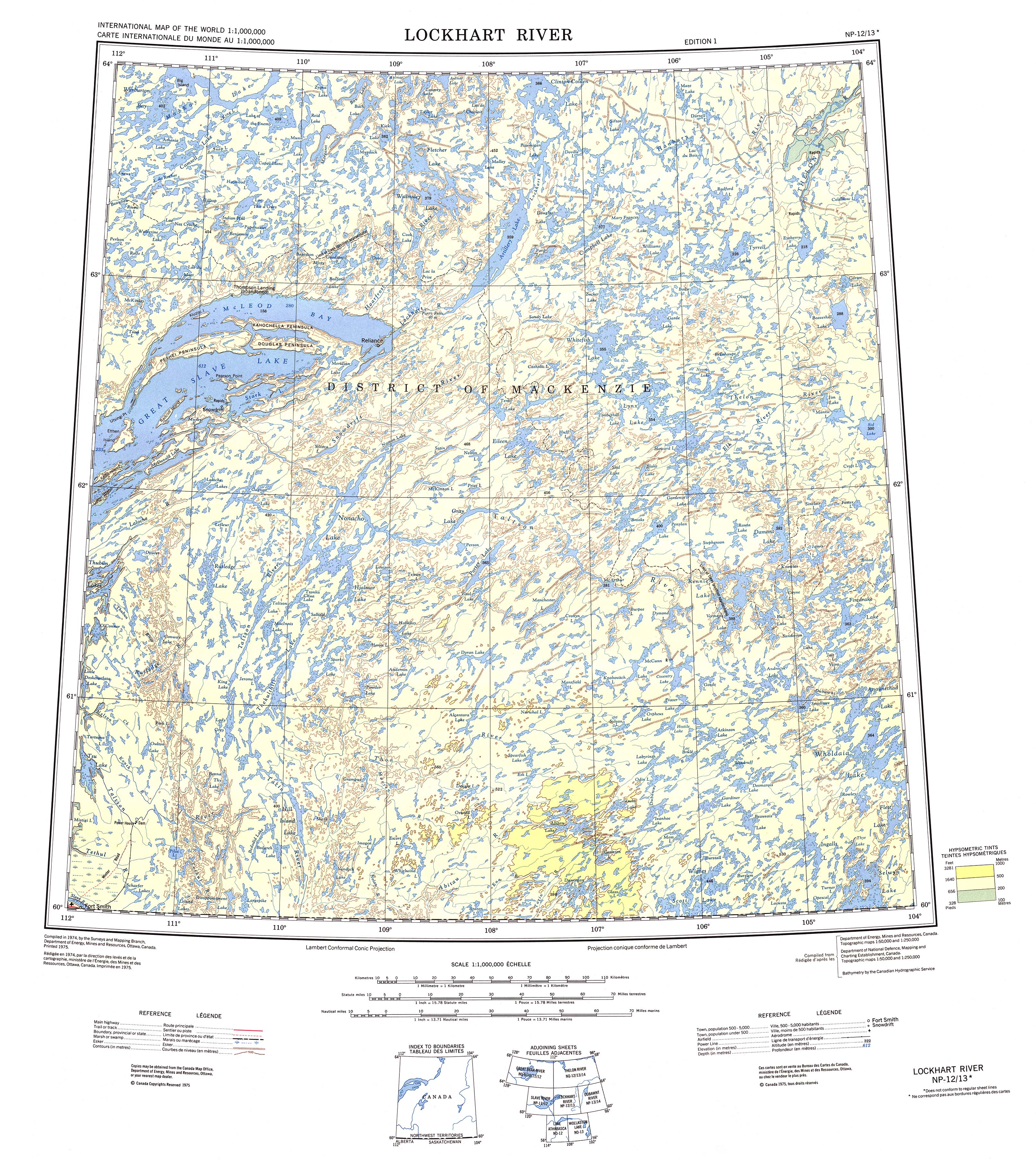
This image is a classic layout that sports the geography of this region with a classic selection of map components.
You have permission to store this file and employ it in your projects. Providing a link to here is very much appreciated.
In case you need aid getting a map, a different kind of map, or need a great individualized preparation, you can contact our map specialists.
Procure good tailor-made maps from us. Our custom maps cover a wide diversity of map elements, in detail: avenues, scale bar, coordinate grid, campsites, miscellaneous features, undersea features, cliffs, or natural resources sites, etc. Map types reach from human geography to city, printed to electronic, national to places.
Great maps are accurate, all-encompassing, and not old. First-Rate map-making by YellowMaps.
To purchase hardcopy maps, for instance road atlases, folded maps, or topo maps, I suggest you marvel at the cartographic delights in our map store You can find more than 100,000 map items.
Contact us about international topographic maps too. We will try to get you any map that is currently in circulation.
Back to Canada map collection