Canada Maps Home > Canada Map Collection > Churchill Falls Map - IMW
International Map of The World: Churchill Falls: IMW-nn20
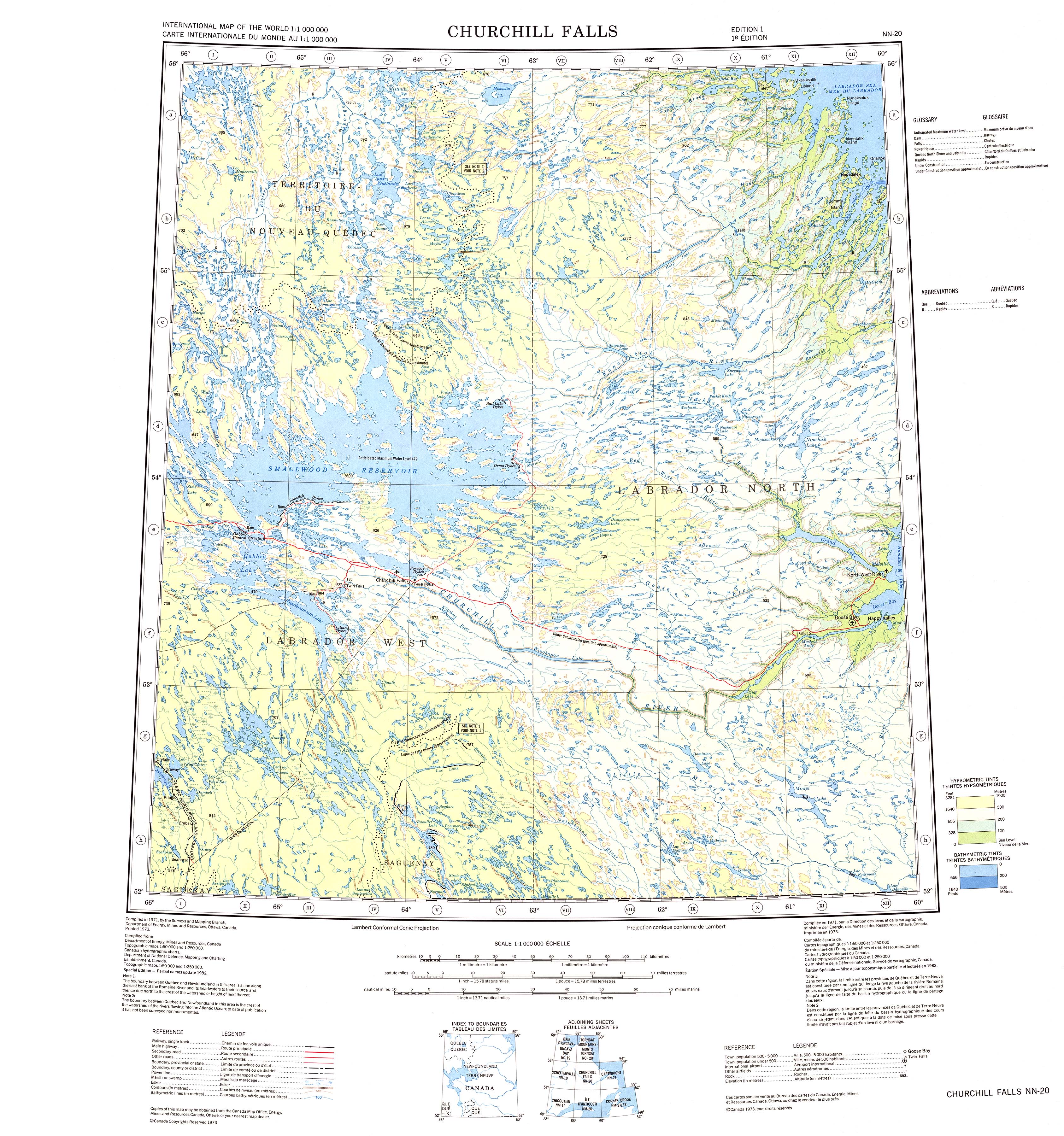
The map above is a simple map brandishing the geography of this neighborhood with a simple medley of elements.
Of course, you can download this image and utilize it for many purposes. Linking back to this resource would be our request.
If you desire assistance acquiring a map, a specific map, or desire a high quality tailor-made map, please do not hesitate to email YellowMaps.
Buy superior custom maps from us. A tailor-made product produced by us have a sizable group of map components, for instance: main arteries, map projection, coordinates, channels, conservation areas, sea features, glaciers, or recreational sites, etc. Types of custom maps range from urban to relief, digital to hardcopy, census blocks to urban areas.
High Quality maps are accurate, all-encompassing, and not obsolete. Fine cartography by YellowMaps.
To purchase paper maps, like navigational charts, folded maps, or maps showing elevation, quickly go to our map shop We hold more than 100,000 map products.
Fun fact about maps: the word 'map' comes from the Latin 'mappa mundi', meaning 'world on cloth'.
Back to Canada map collection