Canada Maps Home > Canada Map Collection > Map of Canada Newfoundland
Printable Map of Canada Newfoundland
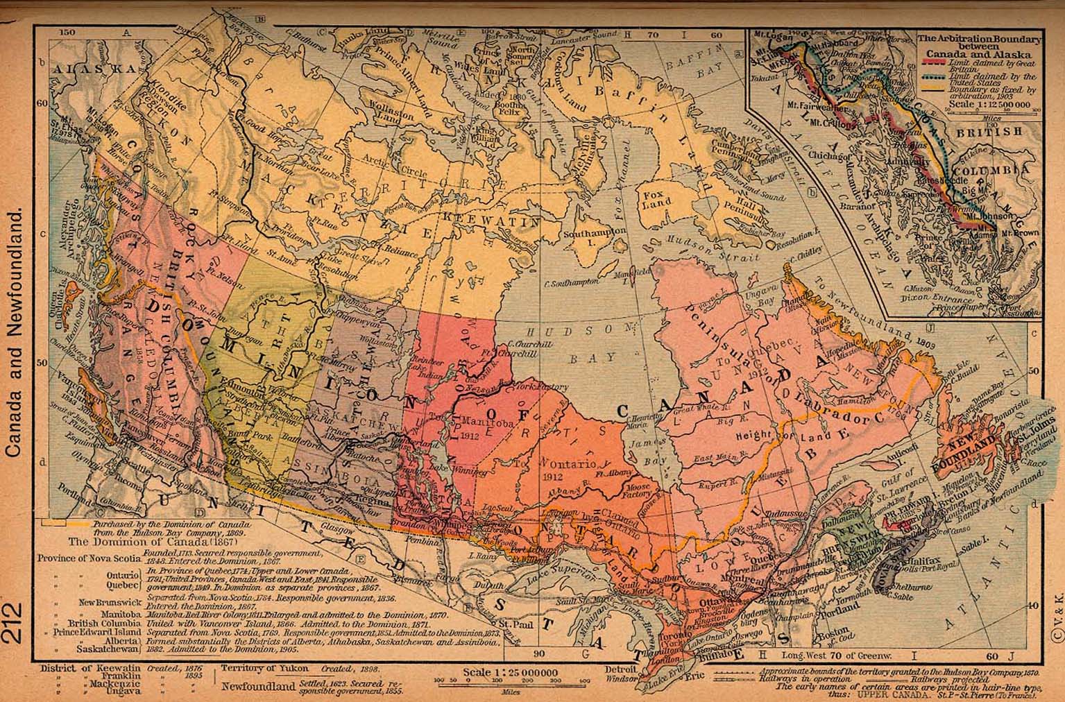
Above, you can see a basic map indicating the geography of this area of interest with a basic array of features.
You have permission to print this image and work with it in your work. Linking back to this resource is always appreciated. Thank you.
In the event you need help retrieving a map, a special kind of map, or need a high quality individualized preparation, quickly email YellowMaps.
Purchase tip-top custom maps from us. Custom maps made by YellowMaps provide a wide group of map elements, like: alleys, scale bar, coordinate grid, air navigation features, marine navigation features, seas, district municipalities, or rivers, etc. Types of custom maps range from street to terrain, digital to hardcopy, regional to zip code.
High Quality maps are succinct, all-inclusive, and not old. Detail-Oriented map design by YellowMaps.
To acquire physical maps, e.g. recreation atlases, country maps, or maps for kayaking, please do not hesitate to explore YellowMaps Map Store We hold over 100,000 items.
When in doubt, just ask us. We answer emails quickly.
Back to Canada map collection