Canada Maps Home > Canada Map Collection > Canada Satellite Map
Printable Map of Canada Satellite
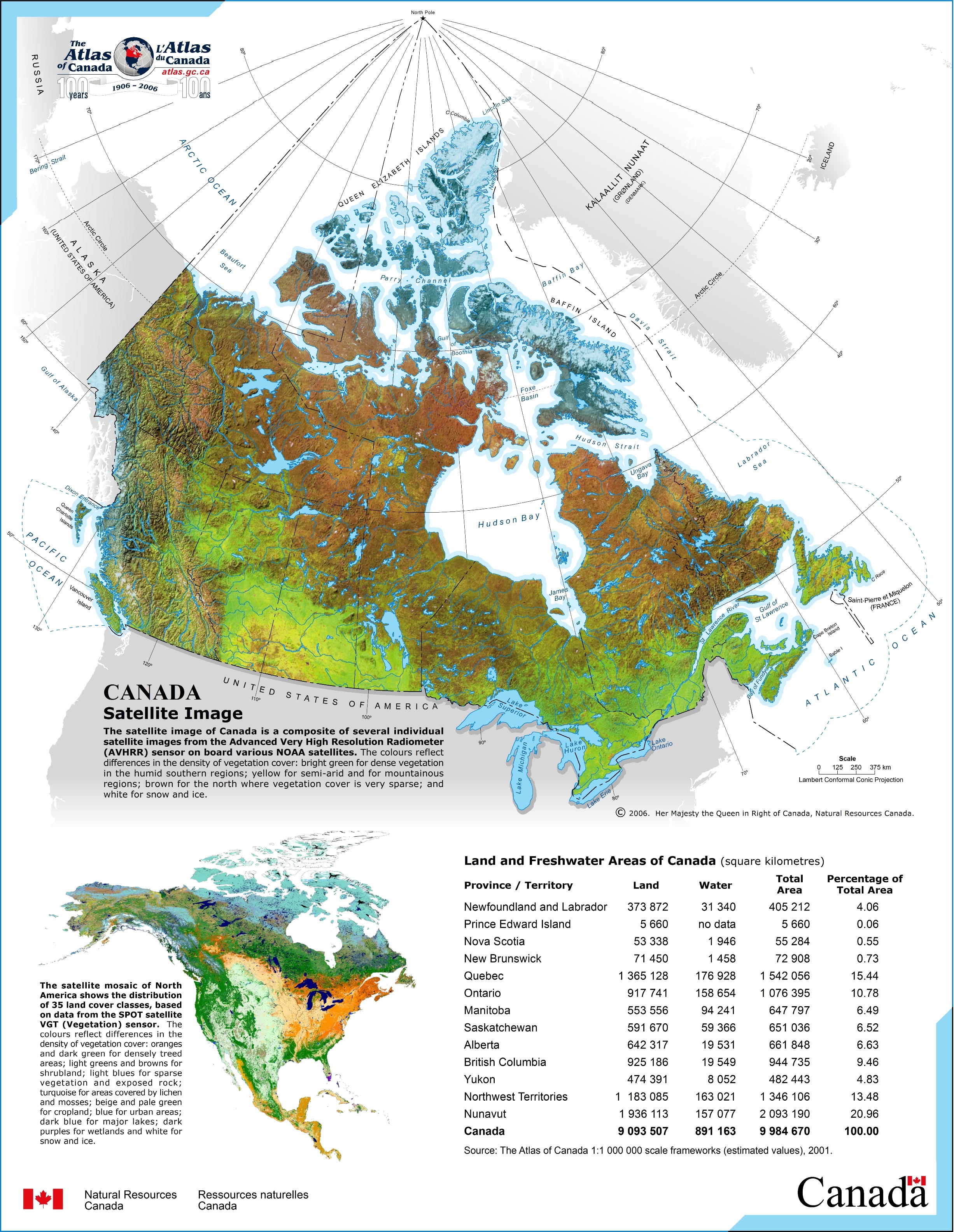
The image above is a plain map indicating the layout of this area of interest with a simple variety of elements.
You are allowed to share the map image and take advantage of it for a variety of purposes. Giving credit to this source would be awesome.
In case you are looking for help locating a map, a special kind of map, or are looking for a great custom cartographic design, simply contact our map specialists.
Purchase great made to your specs maps from us. Our custom maps contain a useful assortment of map elements, such as: boulevards, scale bar, GPS coordinates, channels, conservation areas, valleys, hamlets, or road features, etc. Types of maps vary from political to satellite, navigation to general reference, regions to traffic analysis zones.
Great maps are detailed, all-inclusive, and not old. Expert map production by YellowMaps.
To purchase physical maps, like recreation atlases, attractions maps, or hiking maps, do not hesitate to explore our online map store We carry more than 100,000 map items.
Fun fact about maps: the word 'map' comes from the Latin 'mappa mundi', meaning 'world on cloth'.
Back to Canada map collection