Canada Maps Home > Canada Map Collection > Canada Relief Map
Printable Map of Canada Relief
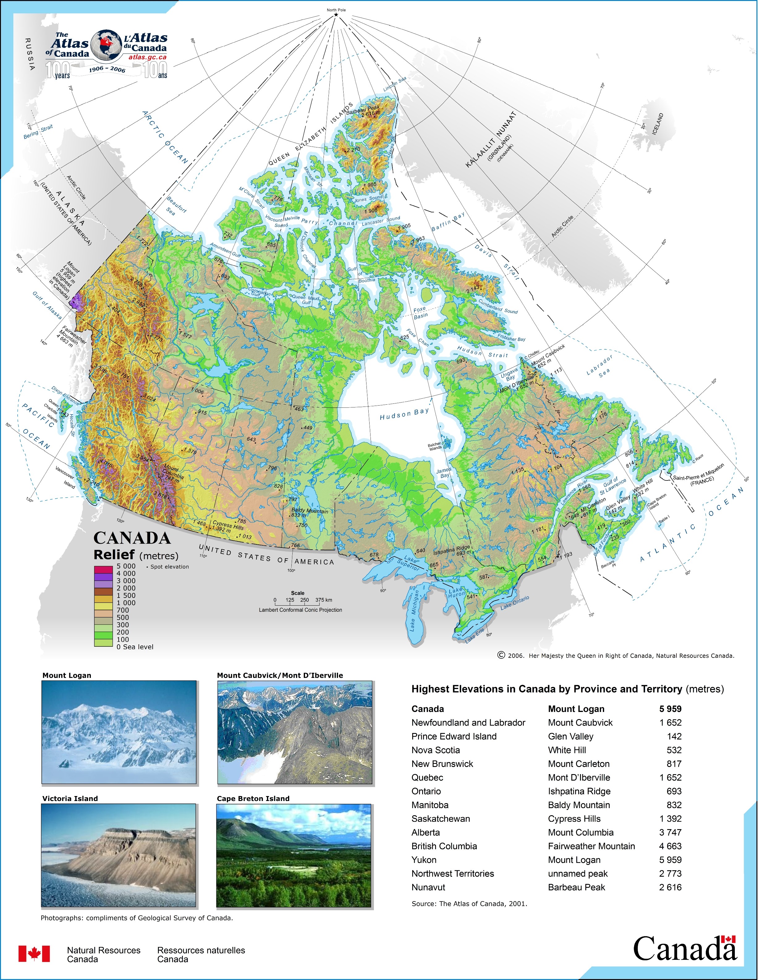
The above is a simple plot revealing the spatial relationships of this neck of the woods with a simple array of details.
You have permission to print this image and work with it for a variety of purposes. Providing a link to here would be our request.
If you request support finding a map, a particular map, or request a superior custom-made preparation, please do not hesitate to email YellowMaps.
Buy great custom maps from us. Our custom maps consist of a good assortment of elements, such as: streets, scale bar, GPS coordinates, air navigation features, miscellaneous features, springs, district municipalities, or railway features, etc. Types of maps vary from political to satellite, printed to electronic, electoral district to places.
Superior maps are specific, all-inclusive, and not old. First-Rate map-making by YellowMaps.
To procure printed maps or charts, e.g. road atlases, attractions maps, or maps for kayaking, you can dive into our map shop There, you will discover tens of thousands products.
Maps are just so interesting.
Back to Canada map collection