Canada Maps Home > Canada Map Collection > Canada Population Density Map
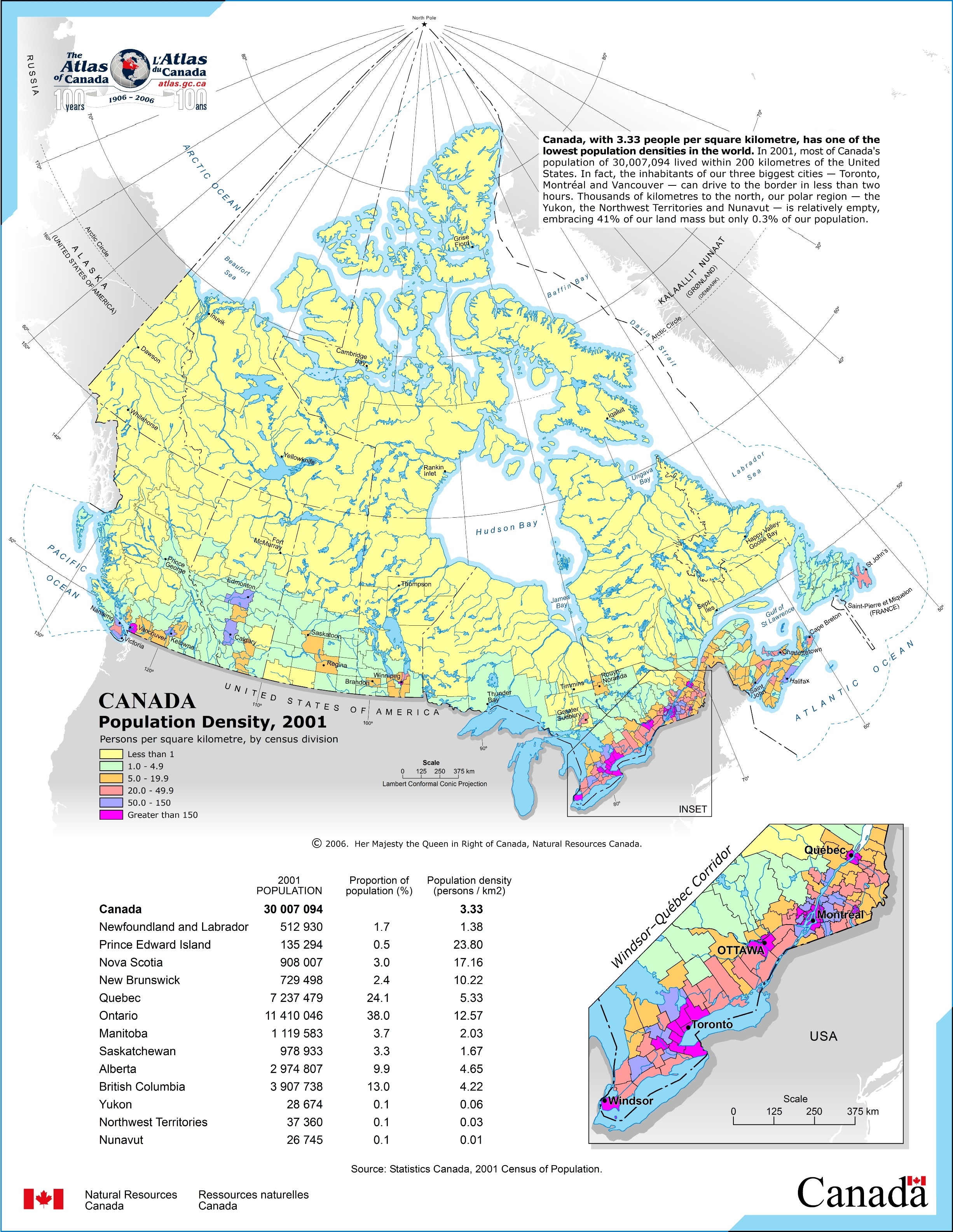
Printable Map of Canada Population Density

This map is a plain figure setting out the geography of this locality with a classic assortment of elements.
You may share the map file and make use of it in your research. Linking back to this resource would be our request.
Supposing you require aid obtaining a map, a different kind of map, or require a suitable customized production, quickly contact our map specialists.
Procure good personalized maps from us. Cuztomized maps by YellowMaps cover a huge medley of map components, such as: trails, map projection, coordinates, beaches, mountains, sea features, forests, or railway features, etc. Types of custom maps range from urban to orthophoto, printable to printed, census tracts to zip code.
Suitable maps are specific, all-encompassing, and not old. Distinguished map design by YellowMaps.
To acquire physical maps, such as road atlases, country maps, or maps for kayaking, I suggest you browse our online map store It has more than 100,000 maps.
Mapping the world. One step at a time.
Back to Canada map collection