Canada Maps Home > Canada Map Collection > Canada General Reference Map
Printable Map of Canada General Reference
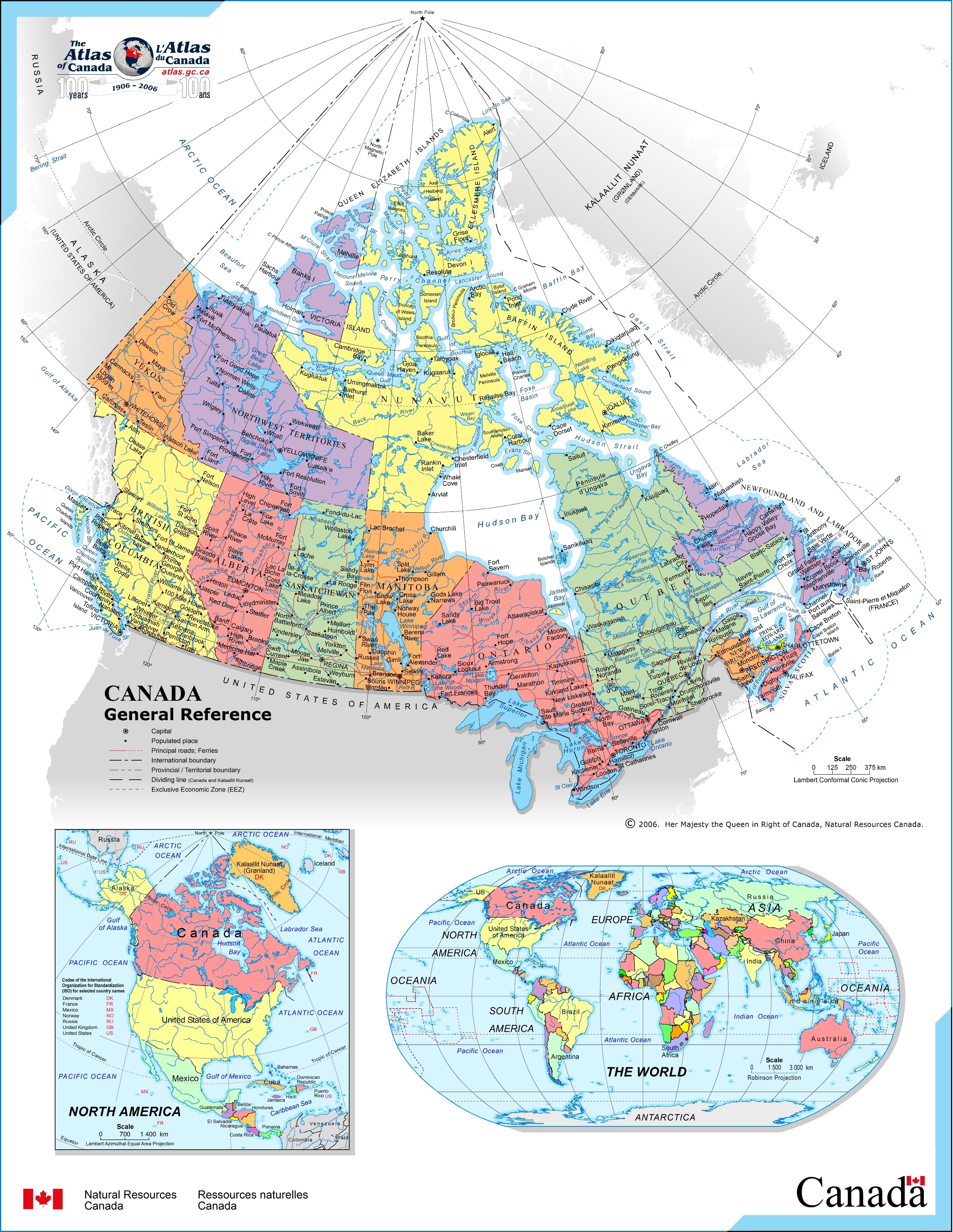
This map is a classic drawing offering the geography of this region with a basic combination of map elements.
You can use the map image and use it in your research. Citing this page would be awesome.
If you want support retrieving a map, a particular map, or want a tip-top custom-made work, you can contact our map specialists.
Purchase first-class specially made maps from us. Custom maps made by YellowMaps cover a sizable group of details, in detail: highways, scale bar, coordinates, beaches, marine navigation features, sea features, glaciers, or plains, etc. Map types range from trail to satellite, printed to electronic, global to school districts.
Tip-Top maps are succinct, all-encompassing, and not misleading. Finest cartography by YellowMaps.
To procure physical maps, for instance road atlases, folded maps, or maps for canoeing, you can pay a visit to YellowMaps Map Store There, you will discover over 100,000 map items.
When in doubt, just ask us. We answer emails quickly.
Back to Canada map collection