Canada Maps Home > Canada Map Collection > Canada Drainage Areas Map
Printable Map of Canada Drainage Areas
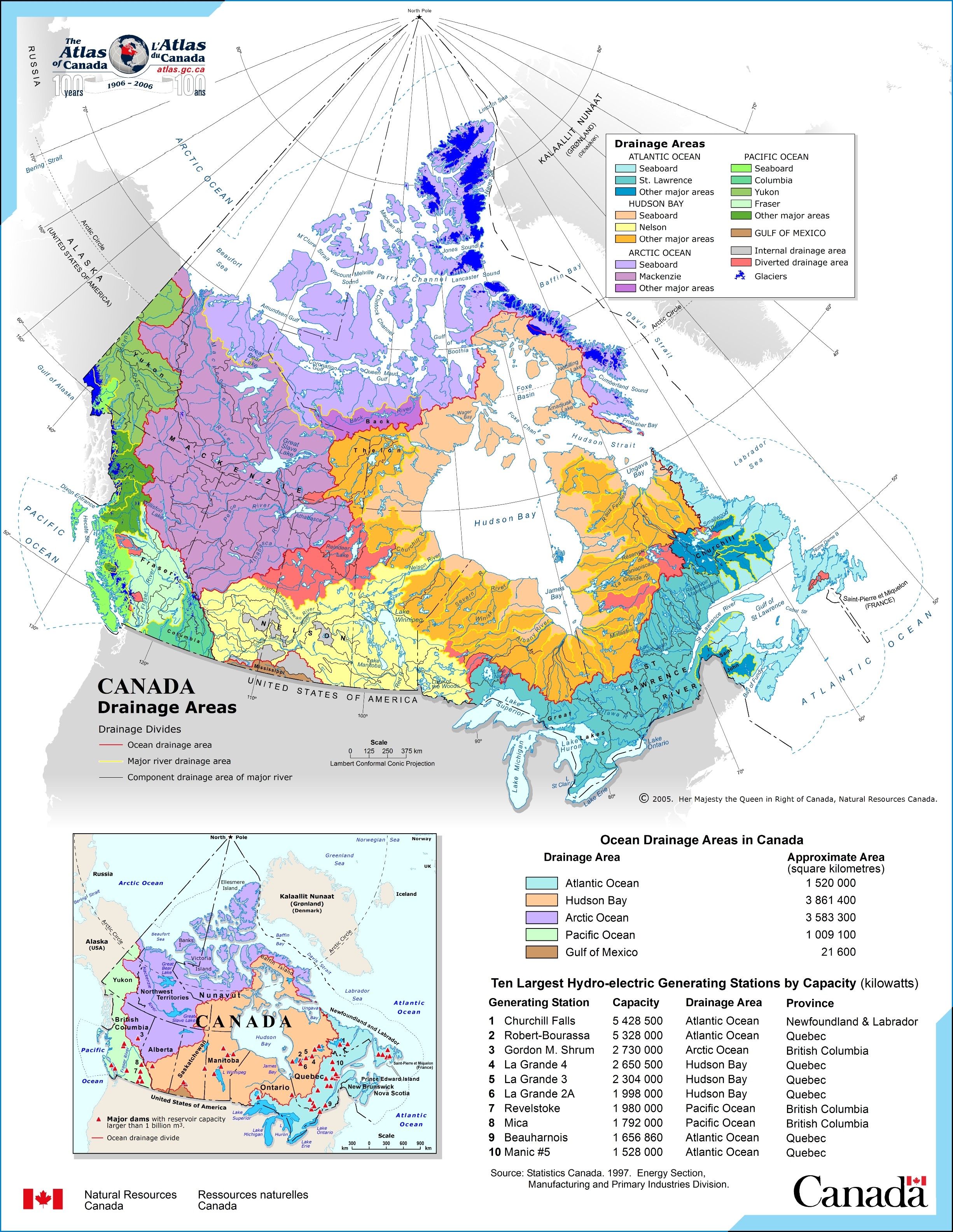
Above is a plain layout exposing the locations of this area of interest with a simple array of details.
You can store this file and employ it for many purposes. Giving credit to this webpage is our request.
If you call for aid getting a map, a different kind of map, or call for a high quality individualized work, please contact YellowMaps.
Purchase good custom maps from us. A custom map made by us embrace a wide group of features, for instance: alleys, legend, GPS coordinates, cities, miscellaneous features, sea features, forests, or recreational sites, etc. Map types vary from street to satellite, printable to printed, state or province to school districts.
High Quality maps are exact, up to date, and not unclear. Distinguished cartography by YellowMaps.
To buy printed maps or charts, for example recreation atlases, country maps, or topographic maps, quickly go to our map store We hold tens of thousands map items.
Maps are beautiful.
Back to Canada map collection