Canada Maps Home > Canada Map Collection > Map of Saskatchewan
Printable Map of Saskatchewan
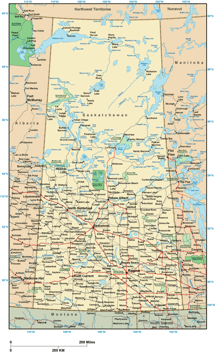
Above, you can see a classic chart that lays out the geography of this environs with a simple combination of details.
You may view the map file and utilize it for many purposes. Giving credit to this webpage is always appreciated. Thank you.
If you request support locating a map, a different kind of map, or request a superior tailor-made creation, I suggest you get in touch with us.
Purchase high quality specially made maps from us. A custom map made by us provide a wide diversity of features, for instance: roads, legend, coordinate grid, bays, major agglomeration areas, springs, forests, or recreational sites, etc. Map types vary from highway to raised-relief, folded to rolled, county level to planning regions.
Superior maps are meticulous, well-defined, and not unclear. Detail-Oriented cartography by YellowMaps.
To order printed maps or charts, such as navigational charts, maps of continents, or wilderness maps, please explore our online map store We have a collection of over 100,000 products.
Contact us about international topographic maps too. We will try to get you any map that is currently in circulation.
Back to Canada map collection