Canada Maps Home > Canada Map Collection > Map of Nunavut
Printable Map of Nunavut
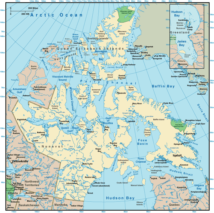
The map above is a simple representation laying out the geography of this environs with a basic variety of details.
You can use the map and employ it for a variety of purposes. Citing this page would be awesome.
In case you need help finding a map, a different kind of map, or need a good personalized map, you can get in touch with us.
Order great customized maps from us. A custom map made by us encompass a sizable collection of map elements, such as: trails, map projection, coordinate grid, district municipalities, lakes, springs, cliffs, or rivers, etc. Map types run from human geography to terrain, printed to electronic, electoral district to public use microdata areas.
Good maps are precise, clear-cut, and not unclear. Fine cartography by YellowMaps.
To buy hardcopy maps, such as recreation atlases, tourist maps, or topo maps, please do not hesitate to go to our map shop We carry more than 100,000 map items.
Cartography is so much fun. Just sit back in your chair and travel states, provinces, and countries, and never even move a leg. Who doesn't like that?
Back to Canada map collection