Canada Maps Home > Canada Map Collection > Northern British Columbia Map
Printable Map of Northern British Columbia
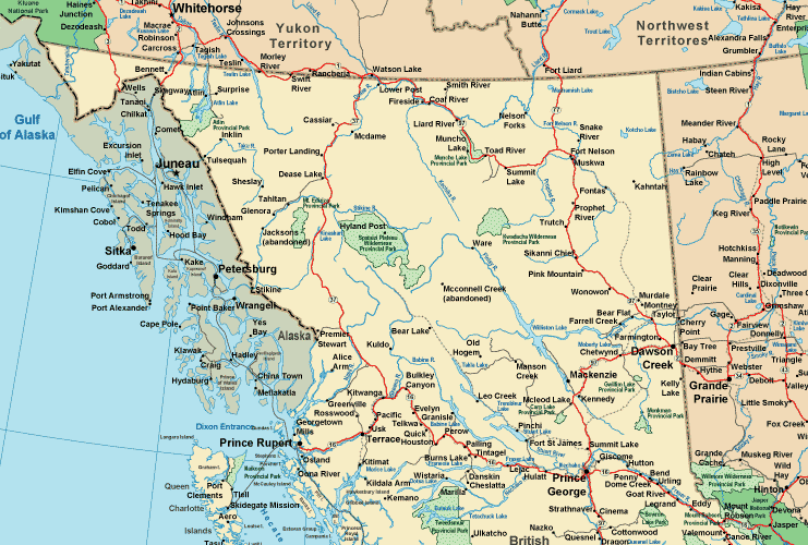
Above, you can see a basic chart sporting the spatial layout of this territory with a plain combination of elements.
You may always use this file and employ it in your research. Giving credit to this source is always appreciated. Thank you kindly.
On the assumption that you are hoping for assistance finding a map, a specific map, or are hoping for a suitable personalized product, just get in touch with us.
Purchase proper custom-made maps from us. Custom maps made by YellowMaps have a large combination of elements, like: roads, map projection, GPS coordinates, district municipalities, lakes, territories, cliffs, or plains, etc. Types of maps reach from urban to raised-relief, digital to hardcopy, county level to state legislative districts.
Suitable maps are accurate, current, and not deceptive. Fine map-making by YellowMaps.
To acquire actual maps that get delivered in the mail to your home, for example navigational charts, folded maps, or maps for canoeing, please pay a visit to our online map store There, you will discover thousands and thousands map items.
We like to help you. If you have any questions, please do ask! We are very friendly :D
Back to Canada map collection